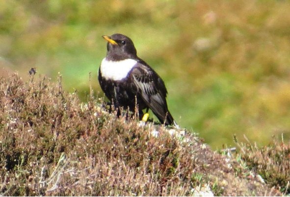
Hob Crag, Rosedale, male Ring Ouzel showing yellow ring, 5 May 2018. (© Vic Fairbrother.)
Back to the Home page
[Ed: Ken Hutchinson has kindly allowed us to offer the 2018 report on Ring Ouzels in Rosedale and other parts of the North York Moors, written together with Victor Fairbrother. The report can be downloaded as a PDF of approx 1Mb.]
Hob Crag, Rosedale, male Ring Ouzel showing yellow ring, 5 May 2018. (© Vic Fairbrother.)
To give you a taste of the report here are the summary and introduction. This is the 20th year of the Rosedale Study.
The 2018 survey was the 19th year in which a detailed study had been made of the Ring Ouzel Turdus torquatus (RZ) population in the North York Moors National Park; only the foot and mouth outbreak in 2001 and the subsequent closure of the moors, preventing what would have been 20 years of continuous study since the start of the project in 1999.
The findings of these studies were submitted to various bodies including the North York Moors National Park Authority, the RSPB Ring Ouzel Study Group, Natural England (York office) and the land-owners and head keepers of Spaunton and Rosedale estates.
As in previous years the 2018 survey concentrated mainly on recording Ring Ouzel activity in the Rosedale area of the North York Moors; an area of around 25 square kilometres. Reports of Ring Ouzel sightings in other parts of the National Park have been included with their approximate location shown on a map of the area. Sightings of birds that are considered to be passage migrants that appear annually across the Moors and along the coast have been excluded from the map.
A topographical map of the Rosedale area has been included for the first time. This shows the approximate location and name of the 40 or so territories referred to in the report. Finally, as in previous years, the north-west and east side of Rosedale was surveyed by Vic Fairbrother and the west side south to Spaunton moor by Ken Hutchinson.
© Ken Hutchinson, Vic Fairbrother, Ryedale Natural History Society 2018, 2019
Back to the Index page